Posts

Showing posts from 2008

Weather Channel Utilizes "Near" Real-Time Images for Road Conditions
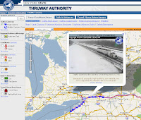
Image
The Weather Channel has taken to augment their early morning traffic and travel reports with webcams of major roadways. It's another sign that people are not just tuning in to hear about their local weather but want as close to real-time information as necessary. Now, it's a too much for the Weather Channel to cover all major metros which is why people still tune into local news stations for helicopter reports and live feeds. But the information that will be required by travelers will be in-vehicle reports with live camera feeds to traffic conditions miles ahead of where the driver is currently. I think more drivers with in-vehicle navigation systems will demand connected devices to show these types of live feeds as many state and city departments of transportation currently do. As an example, the image above is from the New York State DOT. We are certainly getting closer to connecting people with the real-time information that they need.
Boston Globe-Year in Maps: How the Media Discovered Digital Geography

The Boston Globe published a review article on the "cartography boom" that seemed to capture the attention of readers and journalists in 2008. From the presidential elections to the terrorist attacks in Mumbai, the media used maps to better convey the story. As Adena Schutzberg pointed out in All Points Blog , the author deserves credit for recognizing the plethora of maps used by the media and that this was a noteworthy story to cover. I think the author, Drake Bennett, both captured and missed key points. What he got right was that the maps helped to distill the enormous volume of data that pores into news rooms and for that, maps provide an essential tool. What he missed was the sense of urgency and immediacy that readers seek when a breaking news story hits, and that maps and satellite imagery put the reader on the ground. Readers feel much more connected to the story if they understand location and context. Readers may not have been familiar with Mumbai or that it had

To the New York Post - Use the Map...Don't Hide it!

Thanks to a reader, I was informed that the New York Post is using MetaCarta's NewsMap. Great, I thought...another convert to using interactive mapping for local news reporting. But the Post has buried the NewsMap on the NYPD Blotter page . So, they make a fairly big deal of covering local New York news from the five boroughs but don't index every section with the NewsMaps technology. To be fair, the page on which the map is placed indicates that the NewsMap is in "beta" but the Post will never get feedback on whether readers appreciate the technology. There's not much "news" on the map and links from the "news tips" (clicking on one of the triangles indicating a news item) may bring you to a page that has a larger map window but not much additional news. So, my advice to the Post is to make this a little more robust even before you launch this in beta because it is just not that informative and rarely indexes news of interest. I'd advise

Geopolitics and Geography

On Time Magazine's "Person of the Year" cover, there is a map. Yes, it's hard to see unless you're looking for it. Otherwise you'll focus on the image of Barack Obama. The map in the upper left hand corner underscores the importance of the Middle East and that fact that it is one additional crisis of the many that Obama faces as he takes office. Time could have used an image of a militant, terrorist or pirate but a map is the only way to depict the problems that impact a concentrated region of the world that continues in turmoil. And yet somehow I think it speaks to our lack of geographic awareness, our lack of geographic knowledge both of juxtaposition and history. U.S. students continually under perform in a fundamental understanding of geography, culture and politics. It's time that those of us who live in and supposedly understand a world of digital geography where global communication is instantaneous that we take time to better understand cultural g

NY Times Goes Beta with "Represent"

Thanks to my colleague at Directions/ All Points Blo g (where you can find some of the technical details about the map), Adena Schutzberg, and a tip she received from Amy Grahran, there is news out about a new mapping feature offered by the New York Times called " Represent ." By typing in your address you can get information about your congressional or state elected officials, a map denoting the boundaries of their districts, and some news clippings about the most recent activities of these politicians. First, let me say that this is exactly the type of geographical information that should be provided by your local news source. It's short, concise, well-layed out and informative. Spot on! As this is in beta, there are obviously more features or changes to come. Let me offer a few suggestions: Aggregate more hyperlocal news such as from Topix or YourStreet. Sure, the NY Time is not the ultimate source but this type of aggregation is becoming more commonplace and it is a t

Useless Map Fades to Gray

I want to be fair to the Wall Street Journal but sometimes I'm just left scratching my head. In an article in today's WSJ, a thematic map of the median household income in and around the Chicago area was used to show the high income areas affected by the routing of a freight rail line. Canadian National Railway purchased a suburban rail line that they wanted to use for freight to bypass the congested lines through downtown Chicago. In fairness, I think the map enhanced the story. The problem was that you just could not read it. Once again, a shaded gray thematic doesn't really work for a print newspaper. Though the WSJ limited the gray tones to only four, the tones were too faded. And it took me almost five minutes to actually see that the rail line was overlayed on the map itself. It was not noted in the legend and I can only assume that they thought it was obvious. It was not. Now, unless you are faily familiar with thematic maps and you can discern spatial patterns, th

New York Times Explores the Changing Demographics of The Big Apple

One of the lead stories today in the New York Times discusses the demographic diversity of New York City in recent times. A thematic map of the five New York boroughs divided by ZIP code provides some details on median rent and median income between 2000 and 2007. The newspaper reports that a three year study confirms what some have suggested anecdotally about the changes in income, ethnicity, and poverty. For example, there was a decline by 17% of those who did not speak English in the home in Sunset Park, Brooklyn indicating a gentrification of the area that is heavily Hispanic and Asian. While the proportion of foreign born citizens remains the same, the proportion who are now American citizens passed the 50% level. The American Community Survey was the source for some of the data.

Time Magazine Maps the State of American Health

What's striking about some of the maps provided by Time Magazine in their article focused on the state of American Health is that they parallel another U.S. trend: spending on education. Once again the deep South, Kentucky and West Virginia come up short in statistics such as life expectancy and areas such as the upper Midwest, Utah and Colorado seem to trend higher. There is no secret here. Better educated people tend to understand the value of good health and the spatial correlation becomes obvious when you look at a map. This is not only a travesty but a failure of the local government authorities to act. This geographic phenomena hasn't changed in years and the worst part of it is that these states obviously invested their money poorly because another map in the same report shows that Federal Government spending on health care programs is actually pretty healthy. It's high time these officials looked at a map to see what a poor job they've done.

Wall Street Journal Places Image Map of Mumbai Attacks on Front Page

Today's front page of the Wall Street Journal features an image map of Mumbai annotated with the locations of the terrorist attacks. This map has been reproduced in other publications so there is nothing new except some brief notes on the event at each location. The WSJ is a little late to the game with this map especially since the headline on the image reads "Deadly Route" when in fact there is no identification of the route the terrorists took to reach each attack. A reconstruction of the route the terrorists used would indeed have been a better use of the map if such information has already been discerned. However, the online version of the same image map provides a timeline of the attacks from which you could discern the route and this same map has the events parsed by day during the 60-hour seige.

Wired Maps the World of Food, Crops and Politics

If maps do anything, they condense the salient points of news into a single, visual medium. In Wired Magazine's November issue, the author of the article " Feeding the World " uses a world atlas to identify trouble spots that hinder the proliferation of food production. The map highlights the problems related to climate conditions such as droughts or storm-related damage, as well as political issue such as food subsidies or export restrictions.

On Busiest Travel Day of the Year, USA Today Shows Airport Delays

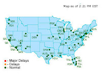
Image
USA Today used its regularly published interactive map of the flight delays to highlight where travelers may find slow going today. The map uses a simple, colored dot to show which airports are experiencing delays. The map is "powered" by FlightView.com a company that has several products for travel information. (Image used with permission)

CNN, Washington Post Provide Interactive Map of Mumbai Terrorist Attack

Both CNN and the Washington Post have developed excellent online maps of the Mumbai terrorist attacks of the last week. CNN used a simple satellite image-map of the Mumbai peninsula and then used simple symbols to mark the location of the attacks but use a tool-tip approach to allow the reader to drill down for more information. The Washington Post used Google Maps mashup with much more annotation to the location of each attack such that it indicated the time of the terrorist invasion. Unfortunately, repeated attempts to articles at the Times of India met with server errors. The Telegraph (Calcutta) did not have much in the way of maps to support news reporting.

New York Times Maps Super-Computing Power

If you can suspend your geographic sensibilities for a moment, the New York Times has created a graduated symbol map of the world's fastest supercomputers in the world. The map is a bit skewed in the sense that the locations of these supercomputers are not exactly in their correct locations on the map though the Times tries their best to balance size of the symbol with geographic correctness. While the locations of the supercomputers are easier to place geogrpaphically in Europe because they are smaller in computing-power, the largest supercomputer in the U.S. lands smack dab in the middle of the map that the Times created giving the illusion that Los Alamos, New Mexico, is somewhere in the middle of the country and Oak Ridge, Tennessee is near the border with Canada. Anyway, I think I would have preferred that the Times try a little harder to maintain some semblance of geographic location. Don't we have enough trouble with geographic literacy in this country?

Baron Services: Weather Technology for TV is Going to Change

Today at our Rocket City Geospatial Conference in Huntsville, Alabama, Bob Baron, CEO and founder of Baron Services (also of Huntsville) gave our attendees a glimpse of TV weather forecasting in the future. OMNI , is a "Google Earth-like" interface that will allow TV weather broadcasters a visualization platform, well, like Google Earth but with stylistic changes that offer greater depth of displaying weather patterns, storms and tools to help TV forecasters. Using high resolution 3D terrain data, 3D building models, and text displays that will turn heads, Baron is delivering a new paradigm that leverages geospatial technology to the media weather forecasters.

LA Times Maps Fire Damage

The Los Angeles Times has created several maps of fire-damaged homes, locations of where the fires began, and animal safe shelters as the region is once again fighting fires in heavily residential areas. The maps are reminiscent of those produced by the Times during last year's devastating fires in the region. More and more, the media is utilizing mapping technology to get the news out and is in many ways becoming the primary source of information to which citizens turn to get updated and near real-time news.

Chicago Trib Points to Geography Week Resources

The Chicago Tribune has set up a page with some great resources to take help readers take part in National Geography Awareness Week (Nov. 16-22).

NBC Chicago Launches Beta Website for Traffic, Live Camera Feeds

Image
So, traffic is, as some at deCarta are prognosticating, "the next killer app." And at NBC Chicago, they have launched a beta website for just such real-time information. I think this is a perfect application for TV stations to deploy. You expect to get your weather info from them; why not traffic? Radio stations have been doing it for years, but there is nothing like a picture to show the way. And with more people purchasing cell phones that are really Internet browers, like the iPhone, NBC Chicago is making the right move. Microsoft Virtual Earth is the mapping app they are using and they have integrated traffic and live roadway camera feeds as well. According to the MSFT VE blog, the app was developed by MyWeather LLC and is getting the traffic info from their "own traffic flow/incident overlay." The thumbnail maps of the 5 highest traffic zones is a nice touch and sure to be clicked on alot.

Google Dribbles out Flu Map; The Media Exhibits Flu-like Symptoms

Image
Many local and national news media contracted the "ga ga fever" by fawning over the story about Google's Flu Map . And while Google's search technology and their ability to spot trends in an unusual, highly Web 2.0 fashion is nothing to sneeze at, I cringe at the media's fevered pitch over Google.org's map. Let's face it, what was the bigger deal? That is was a map of potential flu outbreaks, or was it because Google was able to geolocate based on IP address? I just think that everyime Google cough's up another cool map that the media faints. It was even more telling that only passing mention was given to the work of the Center for Disease Control and Prevention (CDC). CNN specifically mentions in their coverage how Google predicated flu concentrations two weeks sooner than the CDC. But the CDC is constantly updating the number of cases of influenza and reports the results in a weekly report ...with maps included. The media seems to be looking to min

WSJ-It's "the Big One"...SoCal Prepares for Huge Earthquake

Image
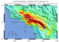
The Wall Street Journal reported today on plans for the Great Southern California ShakeOut ...a huge preparedness drill in the LA area staged by the USGS and sponsors like the Home Depot and State Farm Insurance. Accompanying the article is an interactive map that is a history of some of the more major earthquakes in California. Be sure to click on the "Maps" tab of the WSJ article and don't miss the second map which shows the zones of the greatest earthquake hazards. The image at right is a hazard zone map prepared by the USGS. It is similar to the one shown by the WSJ.

Mortgage Mess

The New York Times illustrates just where the mortgage crisis has taken its toll. Yesterday, the Times reported on the percentage of homes within each state that have negative equity. The source of the data is from First American CoreLogic . California with 29% and Florida with 27% are the highest.

USA Today's "Behind the Results" Map...awesome

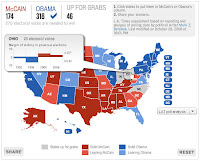
If you love to slice and dice the demographics, you'll love USA Today's " Behind the Results " map. And the slickness by which you can "drag and swipe" the "map squeegee" window that allows the viewer to compare the percentage of voters in that demographic category with how that demographic voted for president is just awesome. The demographic options are older voters (65+), younger voters (18-29), Blacks, Hispanics, and median household income. Kudos to USA Today.

The Election in Hamilton County, Ohio

In its final issue before the U.S. presidential election, Time Magazine profiled Hamilton County, Ohio, a "red" county that had delivered impressive victories for the Republicans dating back to 1992. The article did a nice job of giving a demographic analysis of the county though it would have been helpful to dig deeper by zip code as to the true demographic composition. It was important to understand how much Cincinnati, with a different composition than the remainder of the county, influenced the vote. Time reported that the social conservative nature of the western part of the county and fiscal conservatism of the eastern part of the county formed a solid Republican toehold. On Tuesday, Hamilton County went to Senator Obama by a 52/47 percent margin. The county results are shown on a map compiled by the New York Times . There are no results posted yet by the Ohio Secretary of State for each Congressional District, but I will be watching.

delicious bookmarks - US Elections

Here is a collection of bookmarks I've created on del.icio.us for reference.

In the End...Not Much New...NY Times, CNN Shine

As the results stream in, there is not much new with respect to any additional technology presented by the media. They had already developed their mapping platforms and utilized what they had without showing any add-on functionality; no imagery back drop which CNN tried to do during the primaries (annd didn't make much sense). However, the New York Times and CNN allowed highly user-friendly maps by which to drill down to the county level and view the vote county by percentage by candidate. CNN's map actually was far less visually appealing than what the Times put on their home page. While other sites provided drill down capapbilities (MSNBC), the Times put it on their home page and it was easy to zoom in/out and get the results by tool tip.

CNN goes Quasi "BIM" with Capital Building

At 6:15 p.m. EST, John King unveiled new technology on CNN using a 3D display of the Capital Building and a map of the seats held in the House and Senate by Democrats and Republicans. Though not true building information modeling (BIM), King was using display technology that looked quasi CAD-like. He did not drill down into the Capital Building itself but is that next?

CBS News: Half Telestrator, Half 'magic map'...Half as good?

Jeff Greenfield of CBS News thinks only Iowa, Colorado and New Mexico will put Obama over the top. The interactive map he is using is "half telestrator, half magic map." And yes...maybe only half as good as everyone else maps. I'll reserve more judgment until tonight's coverage.

Maps on FiveThirtyEight.com Fail to Impress

I guess Nate Silver didn't take a cartography course in college but he must have aced his stat class. The maps on FiveThirtyEighty.com serve simply as a guide to Silver's predictions where he now sees Obama capturing 348 electoral votes. Silver apparently also predicted the Tampa Bay Rays "last to first" showing so he's in demand to accurately call the electoral vote count for the presidential election. Silver explains his map to Keith Olbermann on MSNBC...

Wall Street Journal - big on statistics, maps, analysis

Today's issue of the Wall Street Journal , page A5, breaks down the U.S. presidential election with maps and stats. The thematic maps in shades of gray continue to be less potent in terms of being able to effectively communicate the counties to which attention must be paid. However, the maps are comprehensive and useful. The online article does not have any maps but the analysis is worth reading.

New York Times Analyzes What States to Watch by Poll Closing Time

The New York Times offers a state by state guide according to closing hour of polls and what to watch. The video provides a brief demographic analysis of the statewide situation and looks a county level synopsis of the vote as well as a graduated symbol map of the expected voting blocks.

"Twittering the Vote"

A few news sources ( O'Reilly , Poynter ) are reporting how TwitterVoteReport (TVR) is collecting tweets on various issues or problems relating to today's voting. You'll need to know how to use "hashtags" to report your problems or information but it's fairly simple and there's a video by Twitter to show you how it works, but here's an example. If you want to tell TVR that everything is "ok" at the polls where you live, you log onto Twitter and tweet as follows: "#votereport everthing is ok in #21110" where #21110 is the zip code. For other hashcodes of interest, see the TVR website or O'Reilly's list.

ABC Warms Up by Playing Tic-Tac-Toe on their Map

Charlie Gipson and George Stephanopoulos of ABC News were just working at their version of the "magic map" and ended up playing what looked like tic-tac-toe...just placing "X's" and "O's" interactively on the states of most importance. Uh, Charlie, George...you'll have to do better than that tomorrow night as it's just not that informative. The "telestrator" is just a little too "1970's."

FOX News Political Map - Reevaluated

I wanted to check back with FOX News' election map to see if any improvements were made. What I see is that while the maps themselves are unimpressive, the ability to interact with the vote count at both the county and Congressional District (CD) level is useful. The map boundaries present the user with graphics that are much too big and "blank" as they over shadow the information that is useful in looking at the individual races for president, governor, senate or house seats. The user can change between each type of race that that will change the boundary designation. That is, if you are looking at the races for a house seat, you will be presented with the results by CD and this is a useful way to present the information. I doubt many viewers are familiar the the shape of their CD and its geographic extents. Other races are viewable only at the county level.

New York Times Map Illustrates Shift From "TossUps" to "Leaning"

On this Sunday before the U.S. Presidential election, the New York Times is projecting shifts in a new electoral map by taking some states out of the "tossup" column and placing them in the "leaning" column, mostly for Senator Obama. States that had been tossups such as Nevada, Colorado, New Mexico, New Hampshire and Michigain, are now either leaning or solidly in the Obama camp. States that had been leaning toward McCain, such as Missouri, North Carolina and Florida are now in the "tossup" column. And states that were once solidly McCain, such as West Virginia and Louisiana, are now simply "leaning" toward the senator. The total electoral shift now puts 291 electoral votes into Obama's column thus giving him the election.

New York Time Interactive Map for NYC Marathon

This Sunday, 40,000+ runners will run, jog, walk, and run again through the five Boroughs of Manhattan. The New York Times has prepared an interactive map of the race route along with location of places to watch the runners. The page that contains the map has two tabs: one for the race course itself and a second with tool tips of the location of places to eat along the course. But wait, no Carnegie Deli ? Come on! I know it's a block or two just off Central Park South but, gee, you gotta have it on the map!

Chicago Tribune Wins "Tool Tip" Award for Election Map

Image
It's been fascinating to watch how varies publications offer their version of the U.S. presidential election map. At this point, it's almost a given that all of them will let you change the electoral count for each candidate. But the battleground now seems to be what ancillary data can populate the map or in the case of the Chicago Tribune , what the tool tip should show as you "mouse over" each state. The Tribune shows the historical margin of victory for the presidential candidate in past elections. They've made it easy by color-coding by the typical red vs. blue for each winning party. So, the result is a compelling tool that allows the user to determine how deep or shallow the margin of victory is and also provides some intelligence for looking at the current polls to determine if the party has a strong foundation.

Milwaukee Journal Sentinel: Deadly Highway for Drunk Driviers

Image
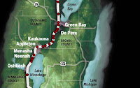
The Milwaukee Journal Sentinel highlights the location of drunk drivers along U.S. Highway 41 between Milwaukee and Green Bay. The map is interactive in that the location of the accident provides details on the driver that was killed and in particular his blood alcohol level. It's a chilling and graphic example that should move transportation directors and politicians to act. That's what maps can do. You can have reams and reams of tabular statistics of drunk drivers and the location of their demise or you can have one map.

To the San Francisco Chronicle - Shades of Gray is the New Black

I'm in San Francisco this week for a conference and I picked up a copy of the San Francisco Chronicle , courtesy of my hotel. Now, I usually don't comment on something as mundane as the weather maps in newspapers but the Chrons' weather map of the Bay Area was so bad that I just couldn't pass up the opportunity. Hello Chron! I can't read your weather map...it's just...gray! There are no shades of gray...just light gray that is impossible to read...with a whole lot of text that is equally hard to read. I think they try to show terrain features but that's a wasted attempt. You can't distinguish roads from county boundaries. And then there are these oblong dots on the map to show air quality. Again...just gray; not a graduated symbols which would be a marked improvement...no, no, they went for a gray dot. Here's a suggestion. Use color, cut down on the number of cities listed, and try to accentuate the geographic boundaries. If you want to show air qua

Christian Science Monitor Offers Psychographic Patchwork

Image
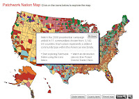
The Christian Science Monitor (CSM) is offering a unique Patchwork Nation Ma p that profiles the psychographic characteristics of potential voters at a county level. The map is not a predictor map or electoral vote maps like others but tries to classify the U. S. into 11 " community types " based on age, ethnicity, education, and income status. Obviously, these class types are more amalgamated groups than those offered by Claritas' PRIZM , Pitney Bowes' PSYTE , or ESRI's Tapestry lifestyle segmenation systems. Each grouping by the CSM map provides a town that serves as an example of each group. For example, Eagle, Colorado server as a representation of the "Boom Town" class. As for the map, the patchwork thematic favors pastel colors that are difficult to discern when compared to the legend. The map itself is fine but to match the thematic map to the legend color is problematic. If you choose the option to remove the county boundaries, you can begin to

National Geographic's MapMachine: Switch to Microsoft Virtual Earth

Looks like the National Geographic made a switch from using ESRI technology to Microsoft for their MapMachine . In 2001, National Geographic began implementing ArcIMS to create its MapMachine. In surfing, I noticed that they made a switch to Microsoft Virtual Earth. That's a huge change for the NG which had been loyal to ESRI for many years.

CBS News' Election Map: Not Even Trying

I guess CBS News decided to look at their competition and simply give up. There is a map and you can pick a winner for each state, but beyond that, the map is ugly, boring and uninformative. And for some reason CBS thinks that you'd want to embed this map into something as they give HTML code to do so. And it's not very up-to-date because as of today, it's last update was Oct. 10. CBS gives you the option of looking individually at swing states but the information is similar to what you can find elsewhere. In fact, that's where most readers should head.

Wall Street Journal's Election Map - More History Than Most.

The Wall Street Journal's election map is not much different than others I've profiled. However, I did like the rollover tips that described the importance of each state. For example, Indiana has only supported a Democrat once in the last 50 years in the 1964 election of Lyndon Johnson. In swing states like Ohio, the WSJ gives brief mention about how the economy may swing the election toward Democrats. And if you are interested in tracking polls, I found the graph of the most reliable media polls to be useful. The graphs shows the latest polling trends over time since June for the U.S. or by individual state.

Boston Globe's "What If" Map of the U.S. Presidential Election

Image
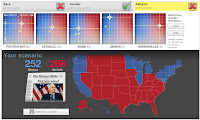
And now for something completely different, the Boston Globe's "What If" map for the U.S. Presidential election is perhaps my new winner in allowing the individual the most options in considering the outcome of the race. Using a variety of demographic variables including race, religion, and ethnicity, the user adjusts the percentage of the total turnout of these groups and to which candidate they would favor. Using a graph of turnout on the Y-axis and candidate "leaning" on the X-axis, the user moves the controls to assign their predictions. You can leave out any of these demographic factors or use all of them. You can default to the results of the 2004 election or in the case of ethnicity, use the exit polling numbers from 2006. There is basis for the graphs in the 2000 Census. The Globe has a succinct explanation of how the controls were create. So, try it and see if you can guess how the percentage of the Catholic vote would affect the election. What percen

Could the U.S. Election Result in a Tie?

The Washington Times published a map that shows how it is possible to arrive at a tie in the Electoral College. The source is Real Clear Politics and the graphic was created by the Dallas Morning News . However, CNN, after last night's debate, had Obama with 277 electoral votes, and the Real Clear Politics' current map shows Obama with a solid or leaning 286.

Precinct Maps Created From Voter Records

Image
For a while, I have commented on the fact that the media will need better geographic detail to more closely examine the geography of politics and in particular the precincts that will sway the vote in an election. Word comes from Farallon Geographics that they were contracted by National Committee for an Effective Congress (NCEC) to "complete the first multi-state, spatially-enabled GIS election precinct data set that covered almost a dozen battleground states." The work entailed compiling over 20 million voter records supplied by the Democratic National Committee. I've asked Farallon to supply more details on how the records were processed to define these precincts because as the graphic at right shows, the raw data is in the form of point records. Oracle Spatial was used to process the point data. Of course the other issue is what this point data represents? Are these actual voters and if so, is there an issue with privacy of these records? So, will the media get th

CNN Magic Map Showing Race Trending Toward Obama

CNN's John King provides the details on a shifting geographic trend on the "magic map" as the U.S. presidential race heats up. Embedded video from CNN Video

ABC TV Website Limits Map Capabilities to News Indexing

The map used by ABC News at their website is disappointing. It is used simply as a means to index the most recent ABC News stories from that state and provides only how the state is "leaning" in the presidential election. A tab on the map shows when ABC will visit the state to cover news there. That's just not news. And if they want to index their news geographically, I suggest they talk to MetaCarta and figure out a better way to use mapping technology.

ABC TV Goes Analog with Map Puzzle

As a kid, I had a puzzle of the U.S. Seems as if the producers of ABC TV had them too. As I watched ABC's The Early Show I wondered if they had taken a look at CNN's flat panel digital "magic map" and said to themselves, "Gee, I think we'll go in the opposite direction; no digital map for us...we'll use a puzzle!" Bad move. As I watched Harry Smith converse with a reporter from The New Republic about which states could move into the Democratic column this November, I couldn't help thinking this was a step "way backwards" from what other news media are using. Smith carried with him large puzzle pieces of the states of Florida, North Carolina and Virginia and placed them on an enlarged floor map on which they were standing. It looked awkward and anachronistic; something I would have seen from the days of Walter Cronkite. Come election night, ABC will have to think of a better way to display results if they want to keep up with their co

MSNBC Map Has Prediction, and County Level Contribution Data

Image
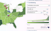
I like MSNBC's county level detail map on contributions by candidate. The supporting bar chart provides perspective to the level of spending as does the thematic map of each county on a state level basis. The map is supported by information on each candidate's campaign schedule in that state. MSNBC's map also allows predictions by the user like other media maps have done. Unique to the MSNBC map are the supporting demographics, simple population, age, race, education, etc. thematics from the 2000 census. It's a nice touch for basic research purposes. In addition, another nice touch is the ability to "magnify" the regions where the smaller states can be seen more clearly.

CNN Updates Map Calculator with New Results

CNN, in their coverage of tonight's debate, has updated their Electoral Map Calculator , putting more electoral votes in Senator Obama's column. John King, in an on-air analysis, looked at Ashland County, Ohio, as a key county that may swing the election in that state. I hope that CNN will update their map calculator to provide more geographic detail. County level detail just isn't cutting in anymore in their online map calculator; we need to see what CNN is seeing at this level of detail. If the election is going to be won or lost at the county level, then we need to understand the demographic composition at this level.

CNN Looks for Consensus with Poll of Poll Map

If you are looking for a map of consensus in the country during this presidential election season, take a look at CNN's Candidate Polling map that tries to aggregate polls taken across specific states. The polls were taken by certain media, research, or academic sources and each state will have differing questions asked. Look for this map to be updated after tonight's debate.

Find Your "Gossip Girl" Hangout

Even the entertainment media has found a use for internet maps and, to a degree, vicarious social networking. The New York Post has created an interactive map of cable TV channel CW's Gossip Girl program. So, if you are looking to see where Lucy stomps on ex-Rufus' heart modeling her wedding gown, then click on #43 on the map to see the location of the Vera Wang store on Madison Ave. The TV show is about the exploits of rich, preppy teens living on the Upper East Side of Manhattan. If you can get by the fact that this is a quasi-soap opera, the map is quite good. It familiarizes the user with the neighborhoods of Manhattan and they've done a nice job of pinpointing the location of various scenes of the program along with photos and notes from the show.

Fox News' New Political Map Leaves me BLANK!

Image
Fox News replaced their political map that I previously mentioned with a new interactive map that is so poorly conceived that it leaves me totally blank. In fact, most of the map is BLANK. Visitors to the website are confronted with a map of the US sitting on a background photo of the White House. There are no details associated with the map other than you can mouse over a state and, lo' and behold, you see...the name of the state! Then, as you click on a state, the only detail that you see are the county boundaries; everything else is just a blank map. Click on the county...again...blank. Try to drill down on the county...nothing. Data at the bottom of the screen reveals information from the 2004 presidential election only. There are no interactive tools to predict electoral vote counts like at other news media websites. There is no way to thematically map the red vs. blue states. A box at the bottom of the screen allows the user to insert your zip code. I tried and it brought me

New York Times Maps the "No" Votes on Bailout Plan

I have to admit I had to stair at the New York Times ' map that they created to show how the votes were cast in the U.S. House's vote "against" the financial bailout plan on Monday September 29. The thematic map of congressional districts showed how the "no" votes were cast and which party cast them; blue for Democrats; red for Republications; and gray for the "yes" votes. It was the thematic map of the "yes" votes that did not differentiate by party that was somewhat confusing because I wasn't sure if there was any attempt to do so. Obviously, though, it was the "no" votes that caused the market to crater dramatically and it was important to show which congressmen and congresswomen cast their votes accordingly. Was there any spatial pattern, any thread of commonality of the voting pattern? I couldn't find any. If you do, let me know what you see!

Follow the Money with USA Today Finance Tracker

Image
Once again it looks like USAToday is on top of mapping innovation with a new series of maps showing the amount of contributions by party or candidate. The Campaign Finance Tracker map provides a graduated symbol map of contributions by state and by party. By clicking on a specific state the interactive map shows a bar chart that filters the information by amount or by month in which the contribution was made. A third bar chart shows which industry contributed to the party. The graduated symbol map is unusual in that in uses concentric circles to show the relative proportion of the contributions. The map is quite different that than developed by the Huffington post that drills down to individual contributors and also represents location as a graduated symbols. Don't forget to check out the map on the independent groups that have garnered contributions. USAToday does not give their affiliation. For example, the Fund for America is affiliate with Democratic causes.

Healthy Places to Retire? How about Connected Places to Nest?

Image
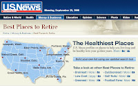
The September 26th issue of US News and World Report published an article and map of the " Healthy Places to Retire ." While I applaud their efforts I feel like they were trying to appease certain areas of the country...that is, wouldn't want to leave any part of the country out of the mix. But Portland, Maine? If I wanted to retire to a cold weather climate, then Boulder would probably be better though pricier choice, as the article suggested. Not in the "first cut" of the top ten but mentioned as one of the "faves" of the readers was my current hometown of Huntsville, Alabama. It's got good golfing, great hiking trails, close to the river (if you like boating, rowing, water skiing), inexpensive housing and truly many retirees thanks to the military. But, for those who are looking for a little more, I'd ask..."What are the best 'connected' cities in which to retire?" I will make the bold assumption that people in my generatio

Kidnap Map

International travel is anxious enough without having to worry about being kidnapped. This week's Forbes Magazine has published a map of the countries where you are susceptible to becoming a hostage for someone's or some group's cause. The weekend's past news of pirates taking an entire ship hostage off the coast of Somalia is a case in point. High on the list are some obvious places like Nigeria and Colombia but then some surprising countries like South Africa and Brazil make the list.

Real Borders; Not Lines in the Sand - Pakistan & Afghanistan

An article in the September 22nd issue of Time Magazine titled "The Central Front" that focused on the calamities of Pakistan's new government and the resurgent violence caused by terrorism got me thinking about borders. On page 38 of this issue, Time presented a map that showed the border between Pakistan and Afghanistan and in particular the region in Pakistan demarcated as the Federally Administered Tribal Areas (FATA). This quasi-autonomous area is suspected of harboring al-Qaida and Osama Bin laden. I've never been to that area of Pakistan but I have been to the northern Pakistan and the areas north and west of Skardu as well as Indian Kashmir and the Ladahki Himalaya . Whether you draw a line on a piece of paper or not as the map in Time showed, there is no border. There are no fence lines or benchmarks or roads that mark these territories. These maps are so inaccurate due to the lack of cartographers willing to actually survey these areas that the borders are

Boston Homicide Map

With crime maps becoming an accepted, indeed, expected resource that should be provided if not by the local government then perhaps the media, the Boston Globe is stepping up with a map of homicides in the city during 2008. The map location is linked to a description of the incident and any other victims of the crime. The online map is a Google mashup.

Wired's Exacto Knife and Mainframe-style Maps Lend Zest to their Smart List

In what I can only describe as a pre-desktop mapping, quasi-mainframe generated, exacto-knife wielding style, Wired Magazine punctuated its article on "The 15 People the Next President Should Listen To" with wonderfully classic maps. The prism and thematic maps that support the article are excellently conceived and presented. The maps have a kind of 1970's-ish quality; very pixelated and reminds me of the early computer-generated map styles of mainframes. The article appears in the October issue.

Economic Globalization on the Move...Follow the BBC Box

Image
The BBC has set about to uniquely watch the globalization of the world's economy. They've set about tracking a container box around the world for one year. Readers can track the box via a map that the publication has created that shows the current location of the container. The container was launched on its journey on September 8th and contains a GPS device and transmitter.

WSJ Combines Imagery, Surge Maps for Ike Predictions

Image
The Wall Street Journal exhibited one of the best illustrations of how a publication can segment its news for both its audience and medium. The weekend print edition of the WSJ (Sept. 13/14) showed a map sourced from both the National Hurricane Center and the National Coastal Development Center ( NCDC ) of Hurricane Ike's storm surge along the Texas Gulf Coast. The black and white thematic map showed a great deal of detail of the stricken areas and the shade gradation used in the maps was certainly adequate to differentiate the most afflicted regions. But online , the WSJ integrated imagery with these storm projects to illustrate just how much flooding would occur to the low-lying areas. (See graphic at right) So, while in print, they decided to use just a thematic, the online version provided them a better medium to display imagery. Good choice because imagery never fares as well in black and white. And they surpased the NCDC website because after several tries to find the source

Zip Codes Rule-Huntsville's Mayoral Race Shows Why

What a coincidence that my own Huntsville Times (Sunday, Sept. 14) should provide fodder to support our poll results by publishing a map of the results of our mayoral election, which will eventually result in a runoff election this October. The map shows how each of the city's zip codes voted in the August elections. The analysis by writer Challen Stephens zeroed in on, of all place, my zip code (35803) as the key battleground in the runoff between incumbent Loretta Spencer and challenger Tommy Battle. The maps shows which zip codes were won by each candidate and a pie chart showing the margin of victory. In 35803, the race was a dead heat and could decide the election as each of the other zips seem to have chosen their candidate by fairly wide margins. Even more interesting, Stephens describes the race by precinct. Now, in a mayoral elections, perhaps zip codes are the essential geographic level by which each candidate must understand their situation. At the presidential election

Poll #1 Results-CNN Needs Zip Codes

Image
The results of our first poll are in and the consensus is clear: CNN needs to augment election coverage by going to better spatial resolution. We asked in our poll if readers believed that CNN needed to use zip codes instead of just counties to report election results. Now, granted, our readers are a bit more conscious of spatial details but in a nearby blog post you will find out why. It's not so much that we like the added spatial detail so much as we get a better understanding of the demographic composition of the electorate. Counties can only allow the viewer to drill down so much an probably for CNN's John King, who controls the large flat panel display on which his maps are reproduced, that may be all the general, mostly geographically illiterate electorate, can tolerate.

Wasilla on the Map?

Image
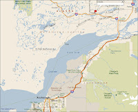
Maybe I don't get all the newspapers that I should but I have yet to see any news outlet show a map of where exactly Wasilla, Alaska is located. Given the popularity of the Republican choice for vice president, Sarah Palin, I've yet to see of map of her hometown. So, here it is. In the map at right, Anchorage is in the lower center left and Wasilla is indicated by the pin. Click for larger view

Perhaps Location and Luck are Related-Buffalo News Maps the Lottery

Image
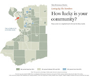
Whoever said that sometimes you have to be in the right place at the right time wasn't kidding. Back in June, the Buffalo News obtained data from the New York Lottery which showed the relationship of winners to losers in Erie County. The interactive map displays the county by neighborhood. Mousing over the neighborhoods shows the number of retailers, lottery sales, and their winning rank. So, out of 217 neighborhoods where do you want to buy your lottery ticket? Head to the East of Belmont area of the Ellwood section of the Kenmore neighborhood--it was ranked #1 (see the red arrow-click on map to go to interactive website). (Source - Investigative Reports and Editors (IRE).

NPR Offers Predictions; Gives You the Chance to Pick Your Own

Image
Like several other interactive maps, National Public Radio (NPR) is also offering up a map to "play" with to choose how the electoral vote will stack up. It too has races for House and Senate and will show you the results of past years but only until 1996. Mousing over the state will show you how NPR is calling the race as well as the results of the " Real Clear Politics " (RCP) results which looks to be an average of some of the other polling firms such as Rasmussen and Gallup.

PLEASE...Make A Map You Can READ-WSJ Should Provide Glasses to Readers

Perhaps its my 50-year old eyes but it drives me crazy when I see a newspaper, especially one as reputable as the Wall Street Journal, publish a map that is barely legible. Page A12 today of the WSJ has a map of Indonesia showing the distribution of the predominant religions as a color-coded thematic. Now given that many of the Indonesian Islands are barely spits of land to begin with, a map thereof with various denominations confined to areas no bigger than a postal code is particularly straining to the eyes. The use of color themes was fine but the map was TOO SMALL. I'm squinting to see where each faith group was located. And in some area, the color bled into another area. Either make the map bigger or point the reader to an online version where the reader can zoom into these smaller areas.

Britain From Above-BBC Offers Gazetteer

Thanks to Jesper Ishoj, a Danish geospatial professional and author of the blog GeoJournalist , a blog similar to Map Hawk, I am able to report on the BBC's " Britain From Above " that I would describe as a gazetteer of the country's unique geographic regions, industries, and culture. The BBC's Andrew Marr hosts the online portal which is based on Google Maps. The portal provides an array of maps, photos, videos, and articles on Britain. It's equisitely designed and you can even download a KML file to overlay similar information onto Google Earth. The BBC itself describes the project as, "a multi-platform project for the BBC...to celebrate their rich collection of programming BBC Archive has gathered together over 60 years of broadcasting from the air." Sharing of videos provided on the portal is encouraged.

Inc. Magazine's Impossible (To Read) Top 500 Map

Inc. Magazine (print version) made a valiant but failed attempt to display the Inc. 500 Fastest Growing Private Companies on a map. A prism map of the highest average 3-year growth rates coupled with a pin map of the 500 top companies truly confused me. I get the pin maps but the improperly developed prism map (accredited to L-Dopa Design + Illustration ) was terribly hard to read. The pins in the map for Tennessee looked like they were in Alabama. They simply made the perspective in the wrong direction. They tilted the map and prisms southward when typical prism maps show the "elevated" or extruded graphic in a northward or "up" position. This double + flip out page spread had a poor choice of colors; most of the states were gray and the prisms in lime green. The map also contained a complicated legend with small icons that indicated specific industries that were just plain difficult to understand. The online version of the article contained a Google Maps mashup o

With Gustav, It's All About the Levees; Fox TV Provides Details

As of this morning, I've been monitoring the TV coverage of Hurricane Gustav on both CNN and Fox TV. While CNN is showing only live coverage of the encroaching storm with standard radar views, Fox has enhanced what viewers see by showing detailed maps of the levees. Both cable news networks are keeping their eyes on any breaches but Fox has in place the maps that show the location of levees in greater detail. The Washington Post produced a map of the levees during coverage of Katrina and shows even better detail.

Gustav-Reality and Prognostications

Image
Maps can tell a story. They can also hype a story and in almost every map I've seen illustrated by the media of the projected path of Tropical Storm and potential hurricane Gustav, it places the storm on a track to make a direct hit on New Orleans. For example, the map at right published by the McClatchy newspapers is a prime example. Only one TV reporter I heard emphasized the "cone" denoting the "possible" path of the storm. No doubt citizens of New Orleans and the Gulf Coast region should be concerned and watchful but I must question some of the prognostications. Even the map of the storm path from NOAA is not quite ready to predict such a direct hit. As a nation, we don't want another Katrina, but we also need to be cautious on how we report threats. The city of New Orleans was accused on not preparing ahead of time. We don't want that this time but weather prediction is not an exact science and some of these maps may show more than what we know cur

A Geography Lession from 1980

In researching the previous post on the map of the former Russian Republics ("Cant Run from Geography"), I found an article , also in Time Magazine , from January 21, 1980, shortly after Russian invaded Afghanistan. President Carter, in an address to the nation, used a map to communicate the importance of the threat posed to this region. From the article, "as Carter talked about the strategic importance of the attack, a color-coded map of the embattled region flashed on the screen. It illustrated his warning that the Soviet jackboot was now firmly planted on 'a stepping stone to possible control over much of the world's oil supplies.'" The resemblance of this situation to the current events in Georgia is uncanny: Russian invades poor country to gain access to oil supplies and presents a geopolitical crisis for the U.S.

"You Can't Run from Geography"

In a Time Magazine briefing , the juxtaposition of the Caucasus, the Baltics, Central Asian and Eastern European countries is starkly revealed in a map as the former Russian republics form satellite nations that now feel threatened after the crisis in Georgia. Author Gilbert Cruz puts it succinctly as he notes that, "you can't run from geography." If you are not familiar with the region, the map is illustrative of the threats these nations have and will continue to face. The map appears on page 20 of the September 1st issue but is not shown online.

Congressial Quarterly Has Your DNC Parties Mapped Out

Partying at the Democratic National Convention? Check out Congressional Quarterly's map of all the nightlife in Denver.

"Now that I know where my house will be swallowed by the earth..."

The East Valley Tribune published a map sourced from the Arizona Geological Survey showing major fissures in the Chandler Heights neighborhood on the border between Pinal and Maricopa Counties. The fissures have been widened by groundwater runoff and cause a major threat to home owners and home buyers. The maps are quite accurate, down to the street level, and provide excellent information on the location and extent of the fissures. What is doesn't provide is an appreciation on how home values might be affected. A cursory look at the same area on Zillow , indicates the obvious surface geology (if you know what to look for - fortunately I don't play a geologist on TV; I am one in real life) but I don't think the home values necessarily reflect the potential property damage that could result if one of the fissures should be extended further or bifurcate into your neighborhood. Let the buyer beware.

Reuters, PBS Miss Mark on Arctic Mapping Mission

Image
Reuters, USA Today and PBS filed stories based on a press release issued by NOAA that provided information on a mission to map the continental shelf in the Arctic to establish mineral rights areas. Though PBS provided a wonderful photo of a Coast Guard cutter there was no ancillary map to support that areas to be mapped or that had been mapped in previous missions. The mission this year will seek to create a 3D map of a little explored area known as the Chukchi Cap. The Canadian American Strategic Review provides a map of this region...see graphic above.

Reuters: Russians Trickle out of Georgia, but from where?

Reuters filed a story of how the Russian army was beginning to leave Georgia. But from what positions they left and to which regions they were headed was not indicated in the story. No map accompanied the story and therefore offered no context. In the case of this particular story, the location of the primary departure routes would help to better understand if the Russians were abiding by the agreement. In addition, it would indicate areas that may be returning to normal and aid journalists with the ability. 

Geo-broadcasting: Geotagging Video News

Much of news is not static; it moves; it is captured in motion; along a highway; in flight...on a dark dusty highway. The move from geotagged photos to geotagged video was only a matter of time and Seero is a company that describes itself as "putting video on the map." Wired Magazine's Keith Barry blogged about Seero and how it asks users to several things to enhance locative media: Track GPS position in real-time and archive a course for playback Geo-tag videos to showcase the destinations where they took place Experience location specific factoids and feeds with a video broadcast These area all items that are missing from online news coverage today. I go back to my comments about the Russian-Georgian conflict. Some many videos were uploaded to YouTube but they had only point-based context. That's fine only to a point. What Seero allows the media to do is create more of a vector-based route map of news that occurs over distance and to offer a live feed that is geot

Is New Media Failing the News Media

The new media embraces location technology. YourStreet, Topix, YouTube, have taken to geotagging news, graphics, photos, and video. But in the aftermath of the Russian-Georgian conflict my search for context to the news has come up relatively dry among the mainstream media. I've searched many news media sites and print publications but most reuse the same old maps. Where's the use of the new media to exploit location technology to tell the story? At least I can point to Google Earth, which has a variety of geotagged YouTube videos from a variety of international media, that help to pieced together the events of the war. But the mainstream media seems completely oblivious to using the new locative media.

Documenting Caucasus War Missing in Maps + Photo Coverage

The war in Georgia is being played out in the media with maps but what's missing is a closer documentation of the fighting using geotagging and tools like Flickr. A diligent search to find photos of where events were taking place resulted in little coverage. Flikr had photos but few were linked to the map. Competing viewpoints are being played out by Georgian or Russian sympathizers on Flickr but they have not tied their images to maps.

"Look at a map..." - WSJ on the Geopolitics of the Caucasus

In one of the most cogent essays on the geopolitical instability of the Georgian-Russian conflict, Melik Kaylan, writing in the Wall Street Journal today implored readers to better understand the narrow land bridge between the Black Sea and Caspian Seas that comprises the lower Caucasus region, which includes Georgia and Azerbaijan. "Look at a map...," he said. At issue is the Baku-Tblisis-Ceyhan oil pipeline that runs through both former Russian-controlled countries and the ability to supply oil to the west without interference from Moscow. In what he called the "Grand Game" is the desire by the Russian Federation to exert much more control over the Middle East by "Findlandizing" the former Soviet republics turned independent countries. By doing so, they control regions of rich natural resources and direct access to Iran and Afghanistan. These are chilling thoughts but best understood with a better appreciation of regional geography.

Washington Post Launches Election Map for '08

Image
The Washington Post today introduced an interactive map for this year's presidential election. Like the map offered by the Congressional Quarterly , it is a tabbed-based map that provides the user the option to view the races for the Senate and gubernatorial races along with the presidential race but did not include races for House seats. The drill down to the state level provides just the basic information on the candidates and primary results and also links to archived stories related to that state. Limited demographic information is also offered and the Post does show a few more swing states in play than does the CNN map . And the Post does a good job of showing the potential electoral votes attributed to each candidate but fails to let the viewer to "play" with the map like that afforded by the USA Today interactive map , which is still the best so far.

CNN Offers Stellar Report on Georgian Conflict

Image
Finally, a reporter who took the time to explain the impact of the Georgian crisis by taking the viewer on a tour of the country using a touchtable screen of the war-torn region. On CNN this morning, the conflict was explained in detail showing the Russian troop advances, the location of the Baku-Tbilisi-Ceyhan oil pipeline and why this region was important geopolitically. The map at right was used during the broadcast and can also be seen online. Kudos to CNN for taking the time to report the story in the context of its geographic significance.

Huffington Post Maps Political Donations

If you are totally amazed at the amount of money raised by the political candidates, you may be surprised at who is donating and from where. The Huffington Post's map of the contributions, FundRace,  to each candidate is a full disclosure account of the money machines and strongholds of the political parties. As the website indicates, you can find out if that new friend is truly a died in the wool supporter or playing both sides of the field.

Georgian Conflict Shows Why Geography is Important in Reporting the News

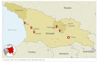
Do you know where South Ossetia is? How about Abkhazia? In reporting the news from these Georgian provinces, it's important to have an understanding of their location. Most don't even know where Georgia is let alone these war-torn provinces. Some news accounts that I've read had very simplistic maps. Others were better at indicating the geopolitical nature of the conflict such as the location of the Baku-Tbilisi-Ceyhan oil pipeline that leads through Georgia from the Caspian Sea to the Mediterranean via Turkey. It is essential that a map(See Wikipedia for a fairly good map ) accompany the accounts to better inform the reader as to the nature of the conflict and why it could draw other neighboring countries into the conflict. What I've seen so far in publications ranging from the WSJ, CNN online, and USA Today, fall short of my expectations. CNN TV did show the pipeline route but the thickness of the line on screen obscured the country and provincial borders. In regions

NBC's 3D Models of Beijing

NBC is using imagery from DigitalGlobe and simulation software from AEgis Technologies to render 3D models of the Olympic venues as well as some of the historic sites around the city. A separate website has been set up by both companies to provide examples of the technology.The models are rendered at 60 frames per second. Some examples of image can be downloaded free of charge.

Mapping Tips for Newspapers and the Black and White Map

Newsprint is not the most favorable medium for reproducing maps and the cartographic quality most often found lacks for a certain "understandability" as a result. As we head into this season of politics, here are some tips for newspapers just in case they haven't figured it out yet: If you have to use black and white for maps, limit the thematic categories to only three. While you think the human eye can differentiate more shades of gray, you would be hard pressed to convince an 70-year old lady of that fact. Even if you use three shades of gray, it might help to use a thicker black border on boundary or polygon data for that third category, just to make certain of the differentiation. (The Wall Street Journal used a map in today's edition (page A9) to show the Democrat's southern strategy and they were well advised to use this heavy black line when using just two themes.) Know your street classifications. Don't get carried away with too much detail on showing

Congressional Quarterly Maps the Basic Info for Federal Elections

The Congressional Quarterly via their CQ Politics online portal is providing all the information about each Senate, House, and gubernatorial election for 2008 as well as the presidential race in a fairly basic, tab-based map that allows the viewer to drill into some of the specifics of each race. For example, if you are not familiar with how the congressional districts are drawn, just choose the "House" tab on the map and you will find a map with the current boundaries. Clicking on a state will display that state and the congressional district boundaries; clicking on a specific district will bring up a separate page with a preview of the race in the district. Included on that page provides great demographic summaries of the district, how the district voted in past presidential elections and campaign finance details. Not great mapping technology but just the basics is all you need sometimes.

BBC Explores OneGeology

Image
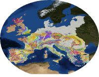
The BBC was first to cover in detail the announcement of OneGeology, a web portal that attempts to put the world's geological information onto a single, seamless map at the fingertips of policy-makers and the average citizen. Most news like this might go unnoticed but as the British Geological Survey was leading this project of which many of the world's geological surveys contributed, they had good reason to break the story. The OneGeology portal allows the users to drill down (though not literally!) to see the subsurface formations of about 36 different regions of the world.

National Geographic's Map of the Day

Image
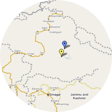
You're a lover of maps, right? Then the only real source for the map-o-phile is the National Geographic. To get your fill of maps, check out the NG's Map of the Day (MOTD). Slight glitch however is that today's MOTD seems to have been repeated for the last 6 days! The 3D perspective view of K2, the second highest peak in the world, shows routes to the summit traced to camps typically used by climbers. However, this particular map has been the MOTD since July 25. Now, in my mind, that's just fine as it probably deserves a week of recognition. But I do have a complaint: this rendering doesn't have an inset map of its actual location. The text explains it as being on the border of Pakistan and China. Now, I've been near K2 but not close enough to see it. Mountains are just a bit high in that region of the world and as any map-maker will tell you, there's no true border that differentiates Pakistan/China/India. The accompanying maps shows you the approximate po

Follow the Frugal Traveler - New York Times

The New York Times is seeing if you can travel through Europe on 100 euros ($156 US) a day by running a series called "The Frugal Traveler Does Europe on a Budget." A Flickr-type map accompanies the exploits of author Matt Gross. The map basically follows Gross' travels in photos and you can sequentially advance the route by advancing frames of the photographs. Nothing here out of the ordinary as far as interactive maps go but I would like to have been a fly on the wall when someone told Gross you're going to spend the summer in Europe and all you have to do is write a story about your travels. Not a bad gig if you ask me and you get 100 euros free. That may not take you too far at a 5-star hotel, but give me a bike and backpack and I'd be happy to travel through Europe!

Online Edition of Danish Newspaper Also Joining Ranks of Supplying Crime Maps

The Danish newspaper, Berlingske Tidende , is using an online crime map solution in their reporting and information gathering process. Due to a reorganization of the police force in Denmark, the newspaper decided to see just how successful it would be. As such, politicians were making promises that more police on the street would help to improve their ability to solve crimes. The paper took it into their own hands just to see keep the politicians honest. --Source: journalism.co.uk

KTTV Fox LA Enlists Caltech for Animated Quake Dispersion

Image
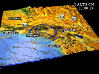
KTTV TV , Fox in LA, used an animated map supplied by Caltech to show the surface wave map (P-waves) dispersion by the 5.4 magnitude earthquake that shook southern California. It's not terribly useful at this scale but does give the readers some indication of the extents of the earthquake and who might have been at risk.

LA Times Covers Today's 5.4 Magnitude Earthquake But Don't Get Shook Up About Their Maps

The LA Times relied mostly on a Google Maps mashup and the USGS to provide maps for the immediate story and coverage of the 5.4 magnitude earthquake that shook southern California this afternoon. The embedded map of the epicenter was just fine but they had the opportunity to make the maps more informative and they had the information but just failed to make it more visible for readers. Just below the mashup were two links to USGS maps: one to the shake map and one to the aftershock forecast . Now, if I'm a resident in that region, I want to know the magnitude of shaking that occurred, especially if I have to justify an insurance claim, and I want to know the predictive aftershock potential. So, the links were there in the online story, but my perspective is that they were buried.

Daily Mail, The Times Online Fail UK Readers on Reporting MyNeighbourhood Crime Maps

Today, the UK Home Office released information that a new online crime mapping portal will be available for all of England and Wales by the end of the years. Both the Daily Mail and Times of London ( Times Online ) ran stories about the MyNeighbourhood.info, website. Both papers covered basically the same information and showed a map example of the website in their online editions but neither linked to the MyNeighbourhood.info website. Both papers are failing readers by not taking advantage of what the web offers online readers in providing simple links.

When You Do a Story about Mapping Technology, It's Always Good to...SHOW A MAP!

Two stories today caught my attention for their "lack" of maps. One in the Fiji Times and one from MyrtleBeachOnline.com reported the use of maps in applications of forestry and hurricane storm tracking . If you are going to do a story on mapping technology it helps to actually display a sample map. For online publications that are not limited by the column inch, it certainly enhances the story to provide links and graphics. The MyrtleBeachOnline.com story buried the link to the NOAA national Hurricane Center's website . That should have been up at the top of the article along with a live feed to the NOAA site which updates the map regularly.

Le Tour is Over but a Recap is Available with New York Times Interactive Map

I was a little frustrated with the New York Times' interactive map of the Tour de France. The pop up that appeared when you moused over the stage number "pin" had no particular locational purpose. At first I thought if you dragged the pin along the route of that stage that you would see the route itself in video or picture form, but that was not the case. Some of the pop ups displayed the topography in profile view which was a nice touch but not all did so. The pop ups served as a reference to the coverage of that particular day and included either links to articles, photos or audio news bites. The map which served as a back drop to the tour route was not particularly pleasing cartographically but I can see that the designers did not want to distract from the remainder of the map information. However, what would have made the map better would have been a Google-style perspective view to bring the viewer down to the surface level to truly see the terrain. You can also dow

Where Are those Nasty JalapeƱos? Hyperlocal News Sites Miss Opportunity

Stories on the wire today (like this from ABCNews.com ) are following the outbreak of salmonella associated with jalapeƱo peppers and how some stores are pulling them from their shelves...but only those grown in Mexico. If I were looking to buy jalapeƱos, but only those from the U.S., I'd like to know which local markets were selling which. A story at outside.in in Dallas yielded nothing nor did I see any articles on the EveryBlock , YourStreet.com or Topix websites that would provide any local knowledge. Now here is a perfect example of how all of those social net "news" sites could help to publicize hyperlocal information and where the mainstream media ought to be plugging in, if those sites had "community sourced" information about the shops where there were both good or bad jalapeƱos. Perhaps I'm demanding more than what should be expected but, right now, the social net sites have either news provided by the mainstream media or sometimes useless blogg